
Trump Posts “Wall of Steel” Graphic Depicting Naval Blockade of Iran
Trump shares a digitally created “Wall of Steel” image showing U.S. warships firing on burning vessels beneath American and Iranian flags.

WASHINGTON D.C. — Donald Trump posted a digitally created graphic titled “WALL OF STEEL” that depicts a naval blockade beneath American and Iranian flags.
Here is the full post on truthsocial: “WALL OF STEEL The Blockade” on August 14, 2026 at 9:38 PM ET.
This is Trump’s 15th message released today, and the last post was 4 hours ago, and it is not part of a thread. On average, Trump produces 18 posts per day since his inauguration on January 20, 2025. The move fits a broader pattern in Trump’s recent messaging, with 8 of his 507 posts over the last 30 days classified as immigration posts.
The image carries two lines of text, “WALL OF STEEL” rendered in a large metallic-style title and “The Blockade” in black beneath it. The graphic is illustrated rather than photographed. It shows five gray destroyer-style warships arranged in a diagonal line, each firing glowing orange projectiles across the water.
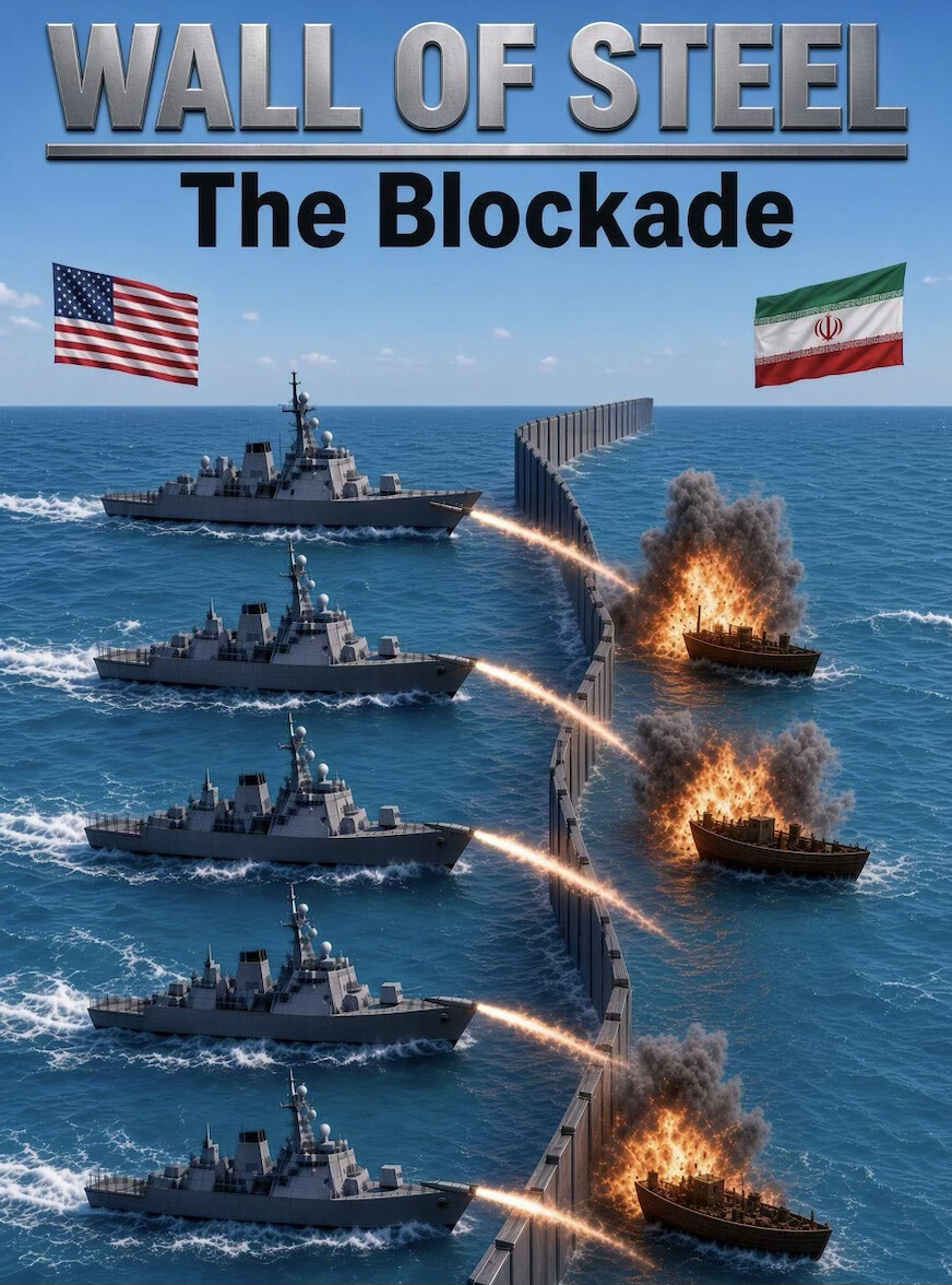

President Donald J. Trump posted a graphic titled 'WALL OF STEEL' depicting a naval blockade online on 08/14/2026.
© copyright Zenger.News
A vertical barrier runs through the scene, separating the warships from three burning and damaged vessels on the opposite side. Two national flags anchor the upper corners of the frame. The United States flag sits at the top left and the Iranian flag sits at the top right, framing the confrontation as a U.S.–Iran maritime scenario.
The post carried no caption beyond the two lines of on-image text and named no location, no vessels, and no date for any operation. Trump provided no policy statement, order, or additional explanation with the graphic on truthsocial. The image itself is a dramatized illustration and should not be read as documentary footage of any real engagement.
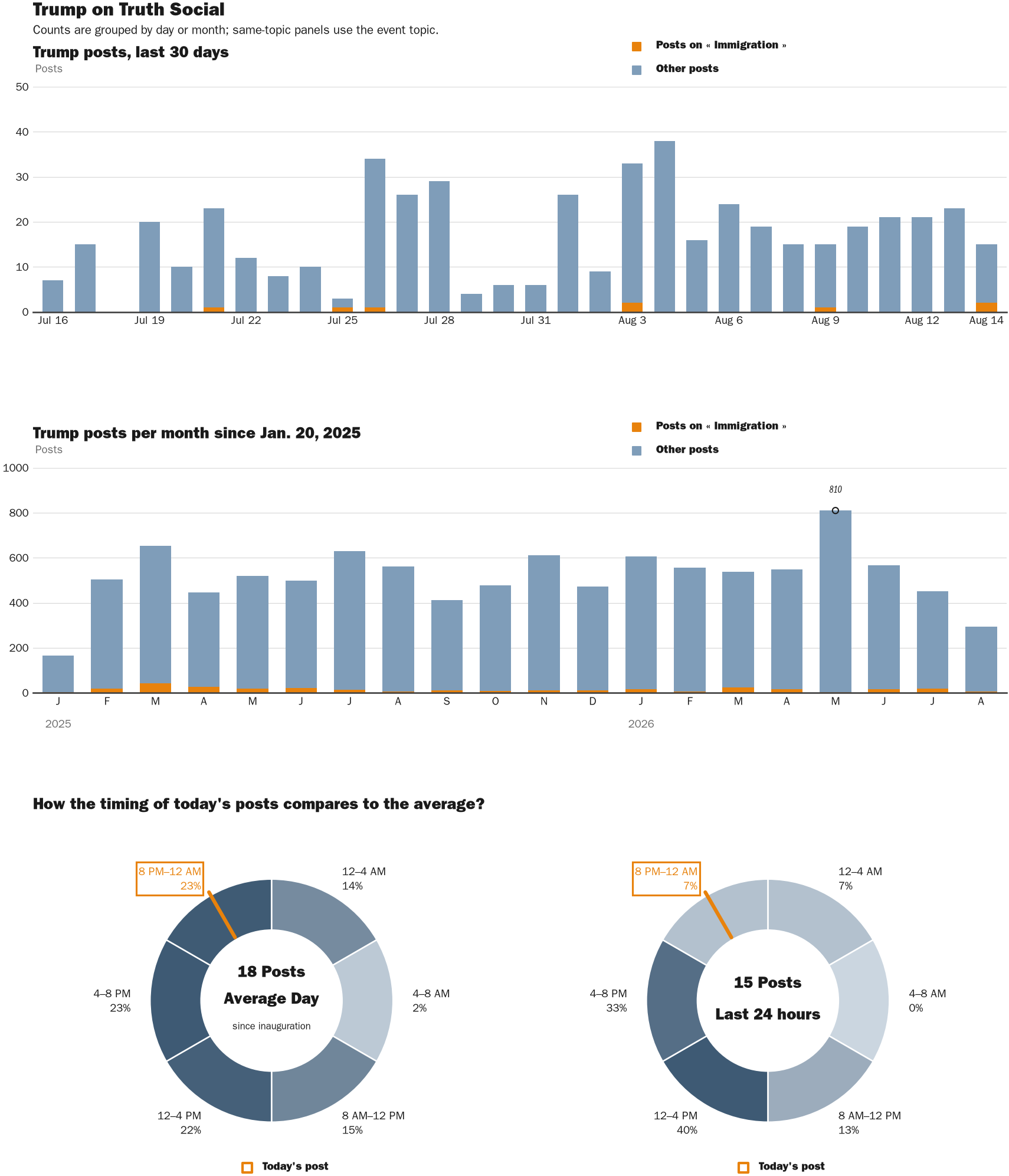
NewsFindr Chart Maker
Photo by Zenger real-time database of all Truth Social posts.
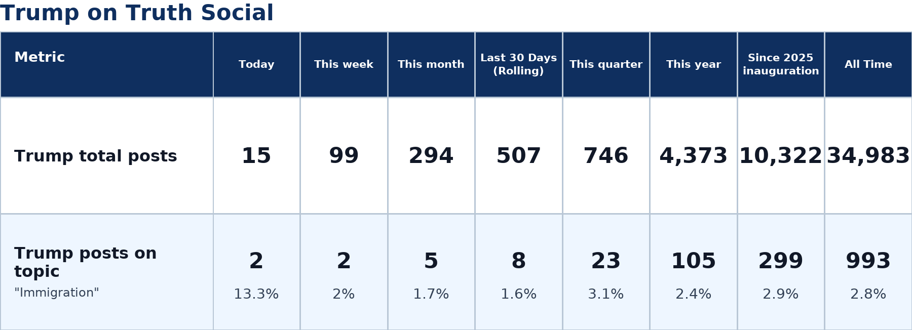
Zenger analysis
Photo by Zenger analysis
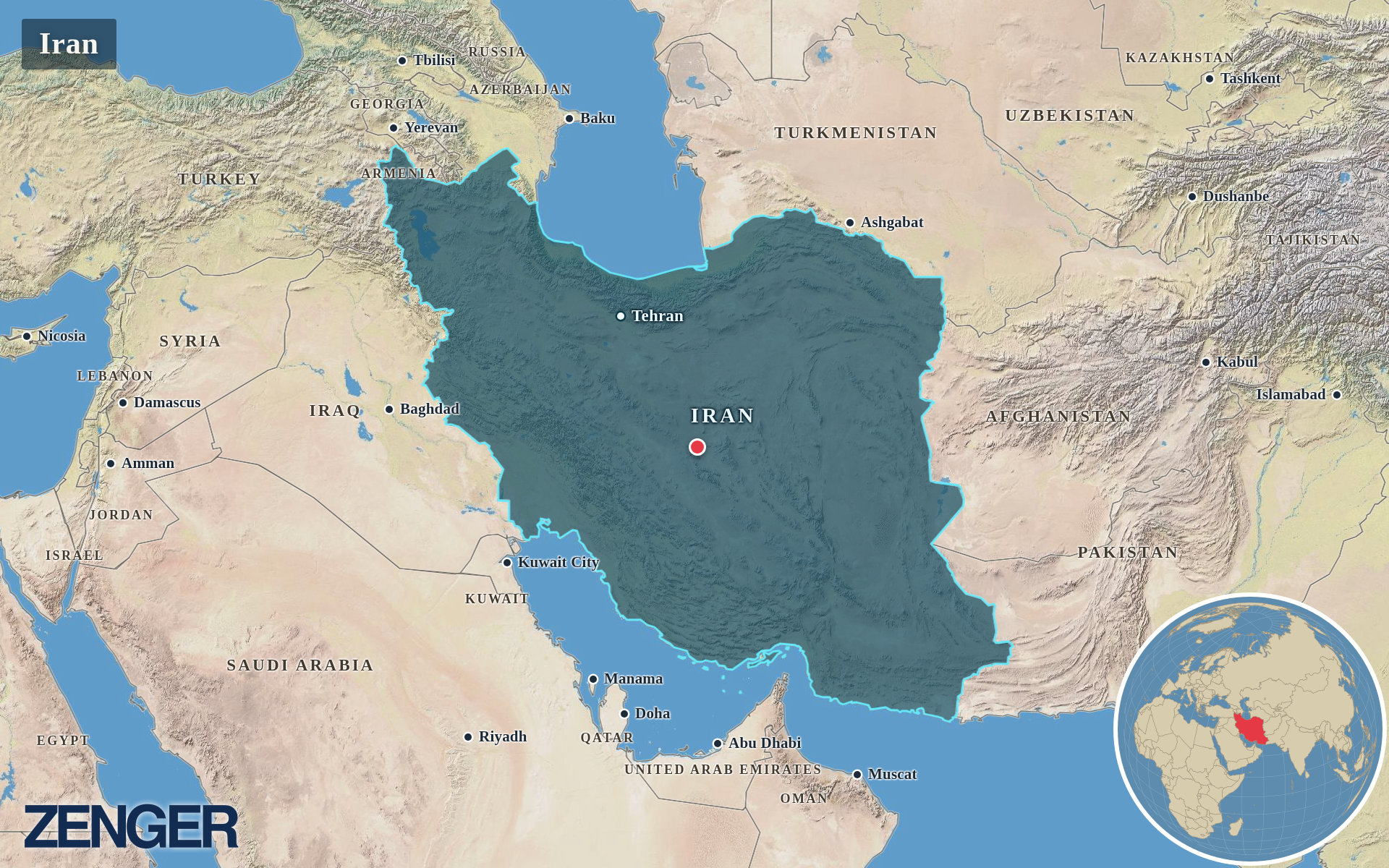
Protomaps / Natural Earth – Iran
Photo by Protomaps / Natural Earth – Iran